This article originally appeared in the February 2023 issue of CONNECT.
Robbie Hunkins (Kochi)
Kamikochi is located in Nagano Prefecture. The park is a mecca for those looking to enjoy the outdoors. There are dozens of trails in Kamikochi. Some simply follow the Azumi River while others head to the peaks of the Northern Japanese Alps. The trails allow for truly breathtaking views of not just the local area but also distant mountains. On a clear day, it’s even possible to see Mount Fuji.
One route of interest is the Kamikochi route. This route follows the Azusa River to its origin: Mount Yarigatake. The path can take several hours to complete, so it’s best to start early in the morning. For almost half of its length, the trail simply follows the river. Thus, it’s a rather easy hike. Even those who wish to hike to Yokoo lodge do not need any hiking gear. Beyond Yokoo, the trail becomes increasingly difficult, so if you were going to take that on, hiking gear would be highly recommended.
Seeking out challenges to grow as a person is what makes life worth living for some. For others, it’s simply because the mountain exists and nothing more. The allure of hiking up one of the tallest peaks in Japan is what drove me to continue to push forward. I needed to know if I could do it.
I made reservations about one month prior to my hike. The mountain lodges do have the potential to fill up. Knowing that I’ll have a place to stay overnight is a great stress reducer. I was also able to arrange a hotel stay in Kamikochi both before and after my hike. That way, I could really enjoy my hike.
The day of my hike started off rather nicely. A strong typhoon had moved through the area the night before. The hotel manager called me in the morning to say that the rain had stopped and that it was time to go. After spending what felt like an hour getting ready, I crossed the famous Kappa Bridge and was on my way to Yarigatake.
The first section is rather mundane. You walk through the Konashidaira Campground; this is where you leave Kamikochi behind and travel through Myojin, Tokusawa, and Yokoo lodge areas. All three have restaurants, lodging, and other amenities. As you pass each and every lodge area, the trail seems to slowly progress in difficulty, but don’t worry too much about this. Overall, the trail is fairly flat with a few rises and falls here and there between Kamikochi and Yokoo.
As I hiked beyond Yokoo, the trail started to become a little narrower. No longer was the trail as wide as the width of a car; it became a traditional hiking trail. The forest grew denser as well. It was quite peaceful overall. One could hear the sound of songbirds over the roaring of the nearby river at times. After another hour and a half, I arrived at Yarisawa Lodge.
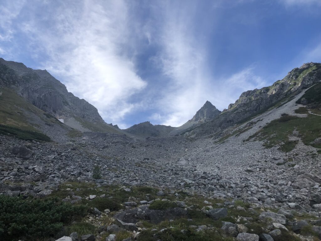
Yarisawa is the half-way point between Kamikochi and Yarigatake. So far, the trail has been relatively easy. However, things are about to change. There’s still another 1,200 meters to climb before it’s all said and done. The trail becomes steeper and rockier the farther one proceeds forward. Even the once-powerful Azusa river has been substantially reduced in power by this point. This area of the trail is much quieter compared to earlier in the day.
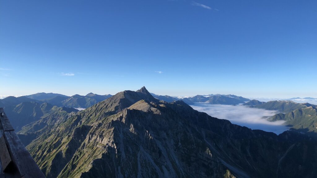
This is the part of the trail where I really started to enjoy my hike. All day long, there were clouds in the sky. The forest and river are beautiful in their own way, but I was here for the mountain views. To be able to see what seems to be a never-ending range of mountains was my goal here. As the day went on, the clouds gave way, and my ascent up the valley was magnificent.
Around 4 p.m., I saw it: the peak of Mount Yari. At long last, my goal was in sight. The peak seemed so close. There on the rocks was a “1500” sign along the trail. There was only another 1500 meters to go. Yet, these are the hardest meters of the entire day. Every step takes more effort than the last. As one keeps moving forward, the walls on the valley begin to give way to peaks along a ridge. There are signs every 100 meters, telling hikers how much farther to go. It was quite motivating knowing that there were only a few more meters to go, each one seeming to encourage: Don’t give up now. Take a rest and look down at the valley below.
The view from here is amazing; you can even see the top of lower mountains such as Mount Jonen. I couldn’t stay there for long; the sun was starting to get low in the sky. It’s already a hard enough hike, and I couldn’t imagine doing that in the dark. So once more, it was time to continue towards the ridgeline and then onto the peak of Mount Yari.
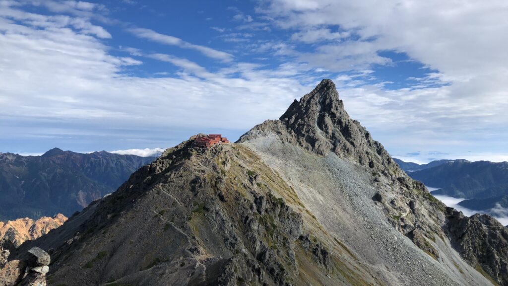
As the trail continues, it also branches off. These trails go to nearby lodges along the ridge line. Pick the right one, and everything will be fine. Pick the wrong one, and you might need to backtrack. After this somewhat tricky section, there’s a sign like earlier in the day that says “300.” Only 300 more meters to go. The sun is really starting to get low in the sky. The once-sunny valley has been plunged into darkness. The trail is more like a rock scramble now. You navigate through the final stretch. Following the “O’s” and avoiding the “X’s”. The “O’s” tell you where to go, and the “X’s” is the path to avoid.
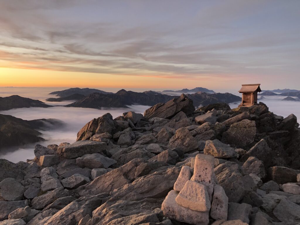
Finally, the ridge line. It may have taken me nearly all day, but it was nearly done. I drop my supplies off at the Yarigatake Lodge and make my way up the last 100 meters to the peak of Yari. At times, I feel that the sun will set before I make it to the top. The scramble up the peak is easy compared to the hike up to the ridge line. Without my pack, I’m able to climb up with little effort. By the time I ascend the final ladder, I make it just in time.
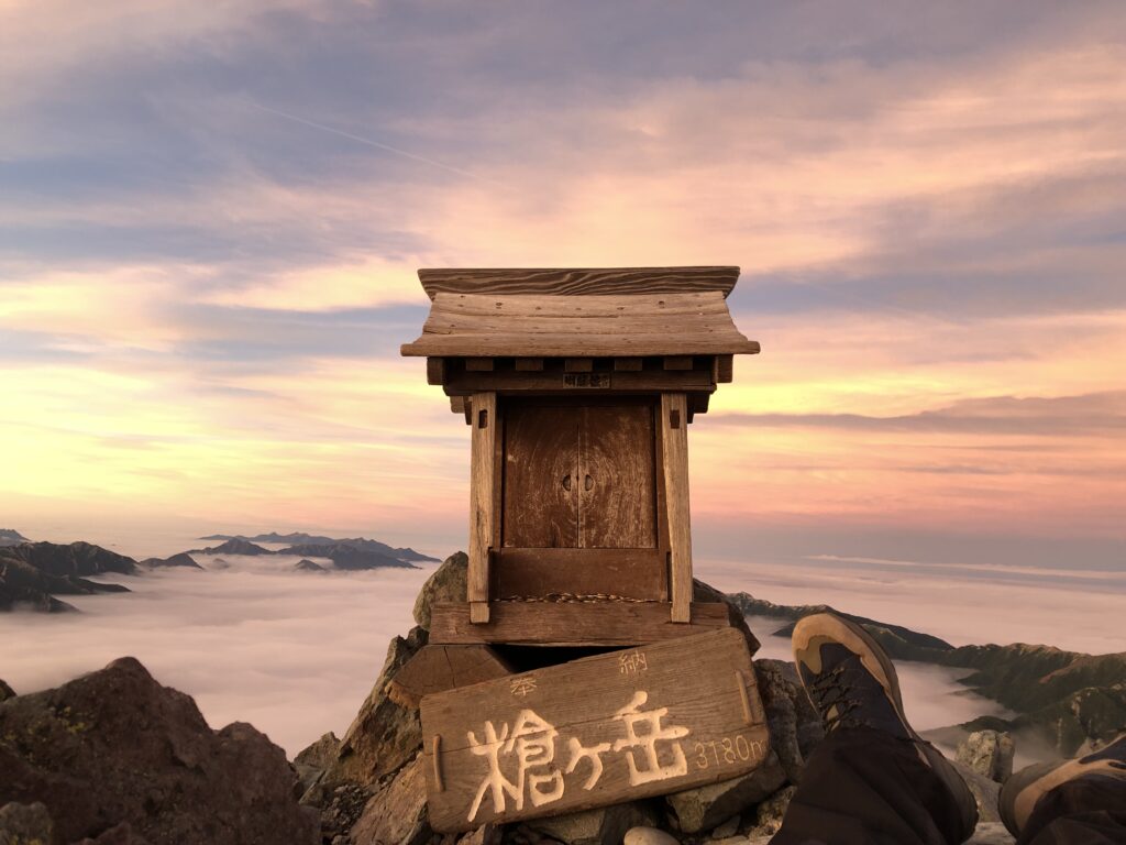
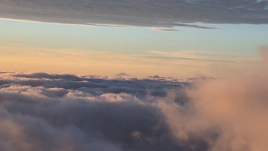
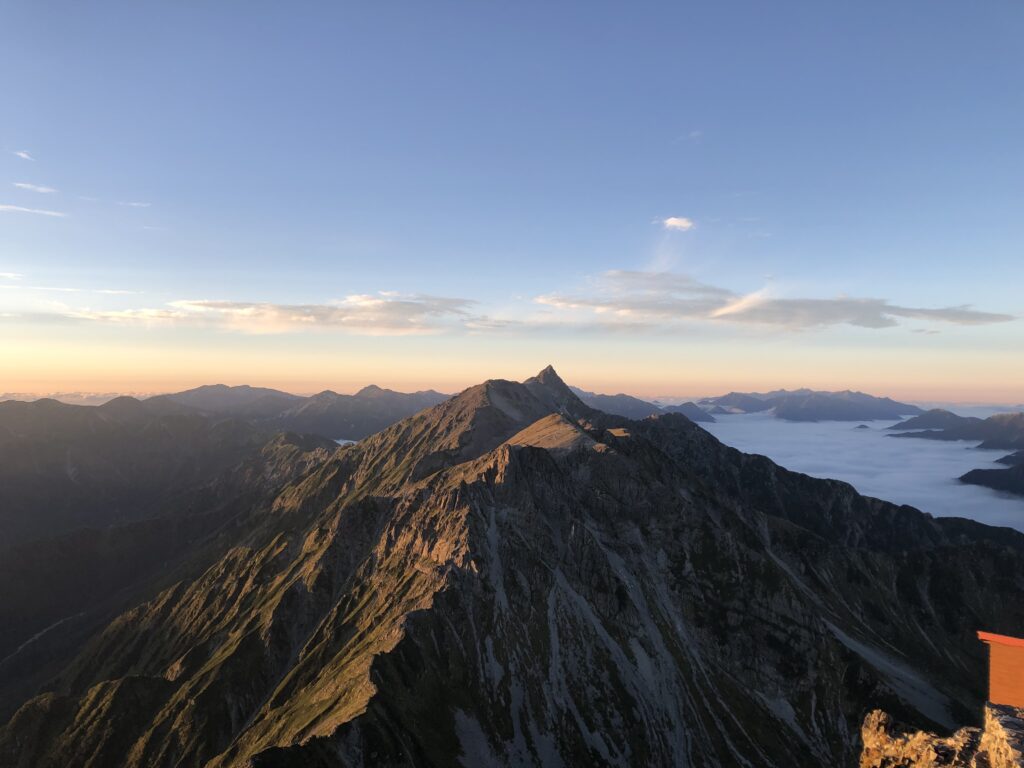
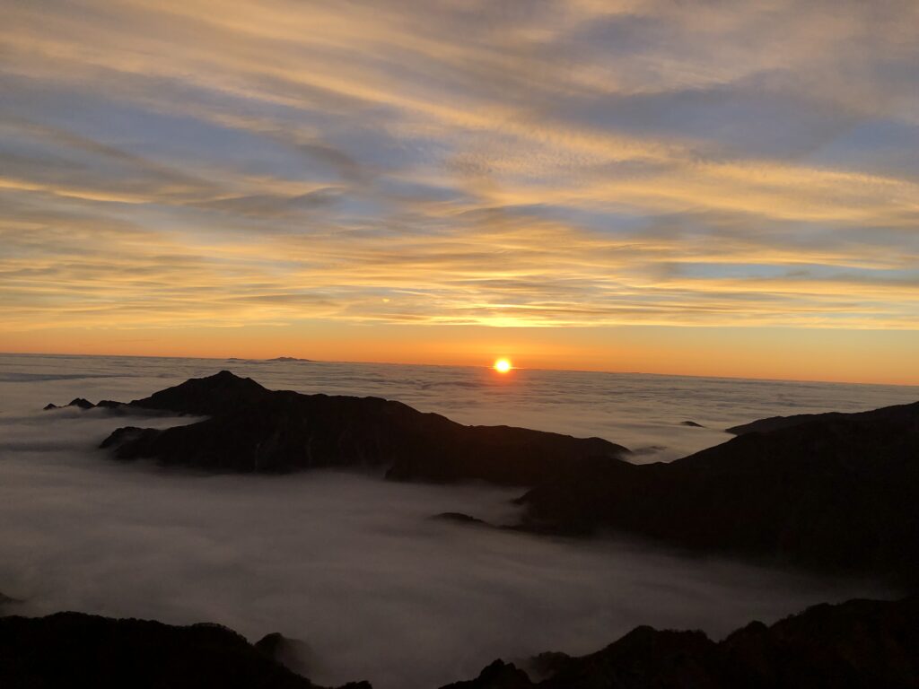
After 8 hours, 52 minutes, I’ve finished. I look all around me, and there are mountains in every direction. The lodge where I dropped off my gear looks rather insignificant. The valley that I spent all day traversing has become filled with clouds once more. From my point of view, I’m on one of many islands jutting out from an endless sea of clouds. This view at the top is truly beyond words. You just have to go and hope that the weather permits you to see a view that seems to go on forever.
Robbie is a 5th year JET ALT based out of Kochi Prefecture. His hobbies consist of hiking, astronomy, photography and gardening. He has been to 34 prefectures, and this winter plans to go to Okinawa for number 35.